Challenge
Im Rahmen einer baulichen Strassenumgestaltungsmassnahmen soll das Potential genutzt werden, gemeinsam den (öffentlichen) Raum zu gestalten und zu nutzen. Mittels neuer Kommunikationstools (elektronische) sowie Austauschtreffen (analoge) soll ein Netzwerk zwischen den lokalen Akteur*innen (Gewerbe, Institutionen, Anlieger) geknüpft werden, welches sich um Anliegen in dem Raum kümmert und seine zukünftige Gestaltung sich positiv auf das Flanierleben entlang der 1,5 km langen Achse auswirkt.
Nötige Skills: Programmierung, Website-Design, Stadtplanung, gesellschaftliches Engagement
Digital-Analog networks for urban planning dialogue
In the context of a structural street redesign, it is important to enable the joint design of and subsequent use of (public) space. Through new digital communication tools and associated in-person exchanges or meetings, a network between the local actors (businesses, institutions, residents) should be established. This network should allow for the integration of diverse perspectives about space and its design to create the best possible community life along public corridors.
Skills: Programming, website design, urban planning, community engagement
DINA Map (Basel West)
DINA Map is a successfull challenge of the hackathon Hack4SocialGood held in Bern, Switzerland.
See the back-end repository: dina-map-api
THE CHALLENGE
As part of a construction project aimed at redesigning the streets in Basel West, the potential should be leveraged to collectively design and utilize public spaces.
By utilizing new communication tools (electronic) and organizing meetings (analog), a network among local stakeholders (businesses, institutions, residents) should be established.
This network will address issues related to the public space and work towards a positive transformation that enhances the pedestrian experience along the 1.5 km stretch in Allschwil (Basel).
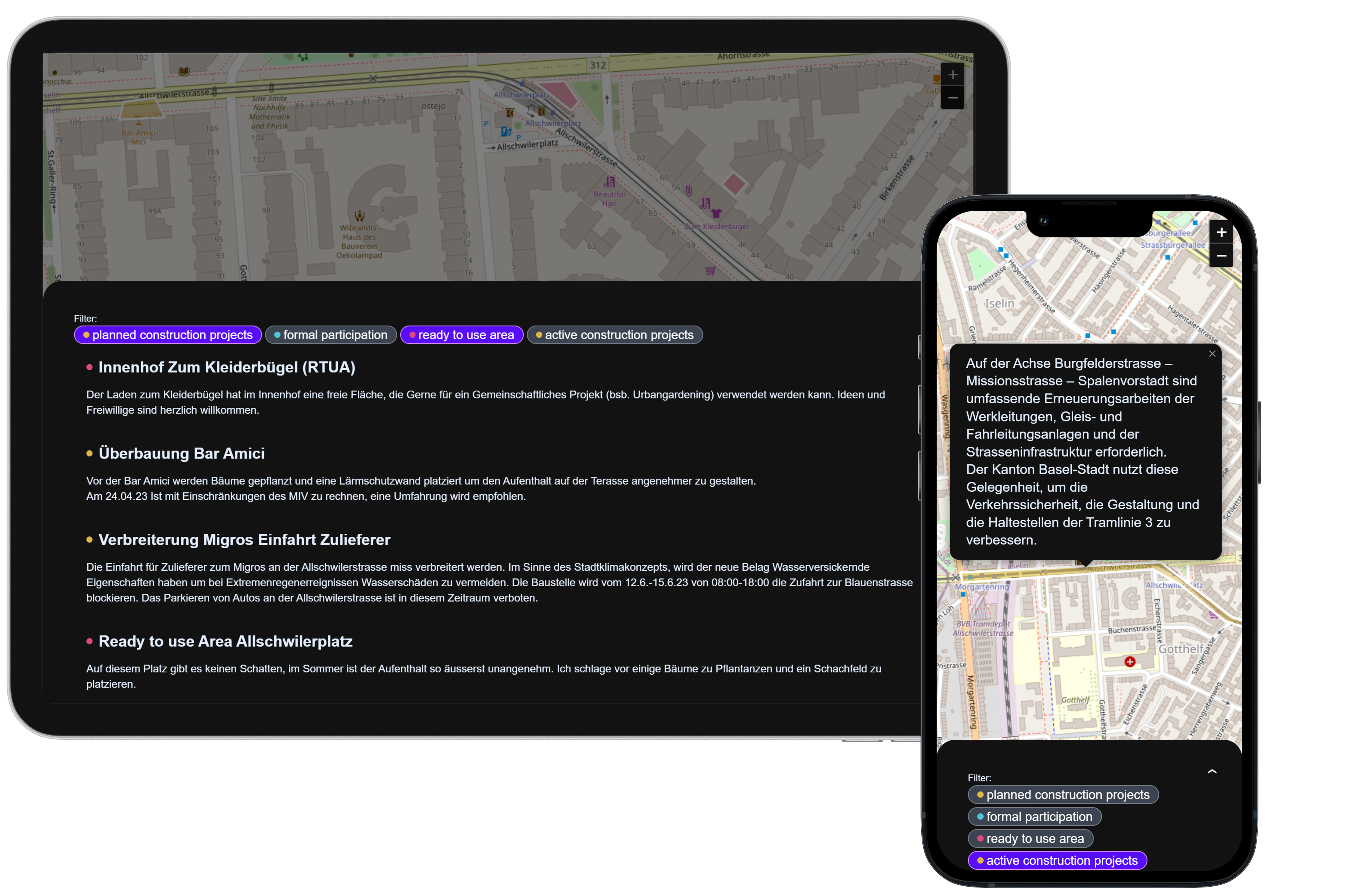
In addition, citizens and local businesses should have a platform that informs them about ongoing and planned construction projects by the building authority, enabling them to provide input or participate in shaping the development of the area when called upon to participate.
THE SOLUTION

The DINA - Digital Interactive Neighborhood App with Map is a web application designed to keep citizens and local businesses informed about urban development projects, while also providing them with opportunities to participate in various construction projects.
It provides information about so called "ready to use areas" to strengthen the awareness of benefits and funding options related to creating a climate resilient neighbourhood.
THE TECHNOLOGY
Frontend:
- React
- Tailwind CSS
- Leaflet
Backend:
- .NET 6 (REST API)
- MariaDB
- Docker
FURTHER STEPS
tbd :)
Previous
Hack4SocialGood 2023
Next project
